| VR-1 [FEMA:53] | (Sup. District 1) |
| Planning level cost estimate of total certification and/or Rehabilitation Work: $13,991,655 |
|
| Total value of property and improvements of parcels protected by the levee: $38,950,170 |
|
| Flood damage prevented: $8,560,728 | |
| Return on Infrastructure investment ratio: 1.15:1 | |
Preliminary Projected 1%
Ventura Westside Community Council PPT (10-07-09).pdf
Executive Summary
As nation-wide efforts to certify all the existing flood control levees, FEMA has identified existing levee facilities within Ventura County. As part of this effort FEMA has requested the Ventura County Watershed Protection District (District) to evaluate the Ventura River Levee (VR-1) and prepare documents for the certification process based on FEMA’s regulatory requirements as identified in Title 44 of the Code of Federal Regulations (CFR), Section 65.10 (44 CFR 65.10).
Certification Criteria are as follows:
- Design criteria (freeboard, closures, embankment protection, embankment and foundation stability, settlement, and interior drainage)
- Operation plans and criteria (for closures and interior drainage)
- Maintenance plans and criteria
- Actual certification requirements (i.e. as-builts, forms, documentation, and data)
As part of the Phase 1 process, Tetra Tech was contracted by the District to evaluate the VR-1 levee system and to recommend a levee categorization to facilitate the levee certification.
Levee Categorizations are as follows:
- Category 1 – Levees meet 44 CFR 65.10 requirements and all data or complete documentation is available
- Category 2 – Levees may meet 44 CFR 65.10, but additional data or documentation is needed
- Category 3 – Levees do not currently meet 44 CFR 65.10
- Not a Levee – Based on physical conditions, low WSEL, no SFHA, and/or not providing flood protection
A levee that is assigned a Category 1 or 2 ratings will be further evaluated in the Phase 2 or 3 processes, respectively, in order to finalize its certification status. A levee that is assigned a Category 3 rating will require a Pre-Design Study in the Phase 4 process and implementation of the required improvements to achieve certification status.
Data collection efforts have been performed to determine what information is available in support of levee certification. Existing information collected and reviewed at the time of preparation of this report includes the following:
- Hydrologic Analysis
- LiDAR Topographic data
- As-built Plans
- Operation and Maintenance Manual
- Inspection/Maintenance Records
A field investigation conducted in early December identified several maintenance issues that will need to be addressed prior to levee certification. Additional field investigations to obtain geotechnical data and additional engineering analyses to support certification requirements will be required to complete levee certification. The specifics of the work required are discussed in this report.
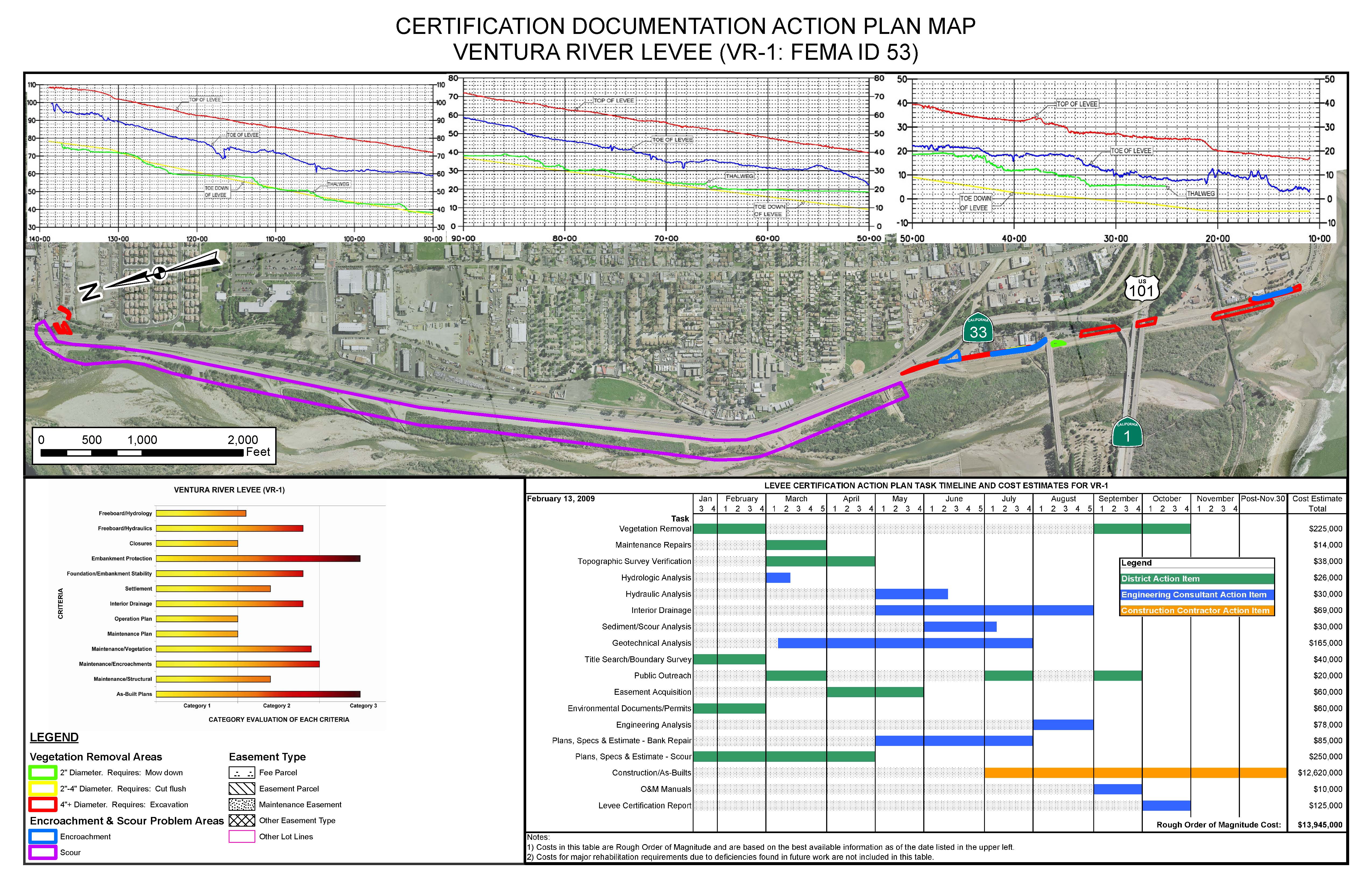
The graphic presented below identifies the extent of work to be accomplished related to each criterion for levee certification. The longer the task bar the more work required to complete certification. This is a subjective analysis that can be best used to compare the relative amount of work required for all the levees being considered as part of the Levee Certification program within Ventura County. The extent of work required can also be used to categorize the levee. The longest task bar determines the recommended categorization of the levee.
Ventura River Levee (VR-1)
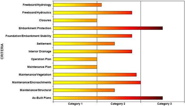
CATEGORY EVALUATION OF EACH CRITERIA
Based on the review of existing data and observations from the field investigation, it is recommended that the VR-1 levee system be classified as a Category 3 Levee. The suggested critical path to achieve levee certification for the VR-1 levee system is outlined in Section F Recommendation.
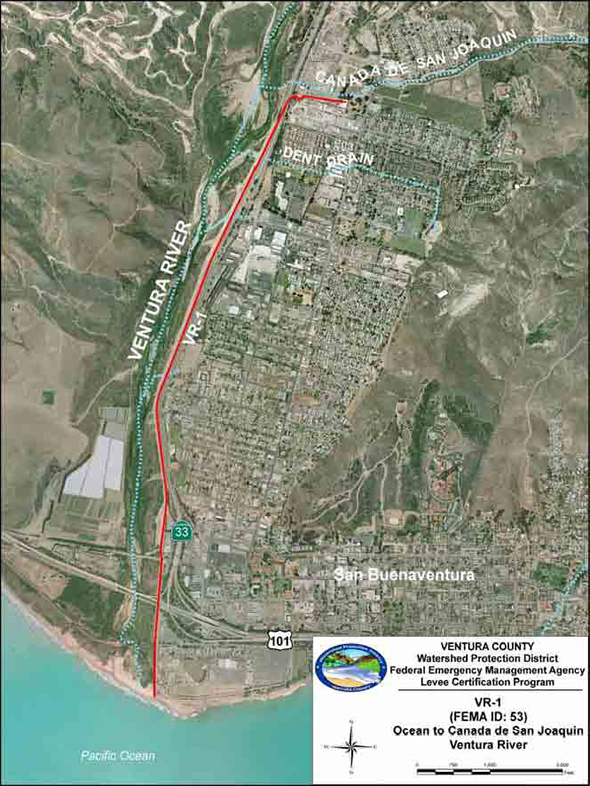
Figure 1 - Location Map
Certification Documentation Action Plan Map